|
|
The CoCoRaHS WxTalk Webinar Bi-Monthly Series
In December 2011 CoCoRaHS kicked off a new and exciting monthly Webinar series called CoCoRaHS WxTalk (wx is shorthand for weather). CoCoRaHS WxTalk consists of a series of monthly one-hour interactive Webinars featuring engaging experts in the fields of atmospheric science, climatology and other pertinent disciplines. These easy to follow presentations are live and approximately sixty minutes long. The audience is given the chance to submit questions which the experts answer live on the air.
Topics have included: Snow, Satellites, Hurricanes, Lightning, Clouds, Tornadoes, Flash Floods, Fire Weather, Weather History, Radar and How to become a Meteorologist, just to name a few.
There are many exciting Webinars on the agenda in the months ahead, so please tell your friends to join us. All WxTalk Webinars are free and most are recorded for later viewing.
*Although headphones are a good way of listening to the Webinars, only a set of speakers is required to hear the Webinar. The audience will be muted so there is no need for a microphone. All incoming correspondence during the Webinar should be in typed form.
Upcoming WxTalk Webinars:
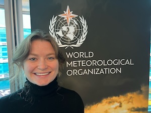
Webinar #90 - Thursday, May 23, 2024 - 1PM EDT
Monitoring Climate Change at the World Meteorological Organization (WMO)
Claire Ransom
World Meteorological Organization
Geneve, Switzerland
Biography
Beginning in 1873 as a forum for exchanging weather data and research, the WMO today is the UN's leading voice on weather, water and climate. One of the lesser known specialized agencies of the UN, the WMO plays a critical role in many matters related to data exchange, climate change and socioeconomic development. This webinar will present WMO, its history and some of the work that it does, with a specific focus on climate change and its impact to sustainable development. REGISTER HERE
Webinar #91 - Thursday, September 2024
Measuring beyond precipitation. How is your forest responding to drought? Peter Goble
Colorado Climate Center
Colorado State Univ.
Fort Collins, CO 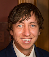
Biography
The US Drought Monitor (USDM) is a critical tool used to assess drought conditions and plan drought responses. However, data collection and monitoring can be challenging, especially in remote locations. Reports in forested areas, both empirical and anecdotal, are often sparse. Consequentially, forest conditions are underrepresented in the US Drought Monitor process, and quality of drought appraisal suffers. Resource managers and professionals working in forested landscapes are often acutely aware of current conditions and are frequently the first to observe drought-related changes in forest/vegetation health, soil moisture, streamflows, and patterns of human use. Peter has worked with the US Forest Service to increase CoCoRaHS Condition Monitoring in forested areas across Colorado. Targeted outreach raised the number of Colorado CoCoRaHS Condition Monitoring reports collected in the months of May-September from 346 in 2021 to 610 in 2022. These additional reports were used in the US Drought Monitor Process to observe progress in forestland health as drought conditions ameliorated during the 2022 monsoon season. Additional Condition Monitoring reports were particularly helpful on the San Juan National Forest. May-September participation increased from 3 to 39 reports in Archuleta County and from 16 to 52 reports in La Plata County.
In this webinar Peter talks about what we have learned from these additional Condition Monitoring Reports in forested areas so far, and plans to continue to fill the drought impact data gap in forested areas.
Webinar #92 - Thursday, November 2024
Meteorology and the Law: The Use of Weather Experts in Litigation Alicia Wasula
President
STM Weather
Cropseyville, NY
(Biography) While most people think of meteorologists as scientists who spend their time looking forward into the future to make a forecast, forensic meteorologists spend their time looking backward at weather events that have already occurred. Many types of litigation involve the weather in some way: personal injury, property damage claims, wrongful death, and even criminal cases. Forensic meteorologists are retained by attorneys as 'expert witnesses' to explain to them and to the court what the weather conditions were like relating to a particular incident. Sometimes, expert meteorologists must give opinions as to how the weather conditions played a role in the particular event involved in the lawsuit. Observational data from many sources, including CoCoRaHS observers, is synthesized into a chronology of weather events. Although many cases settle outside of court, forensic meteorologists are at times required to appear in court to discuss their research and explain their opinion to a judge or a jury. Many forensic meteorologists hold the AMS Certified Consulting Meteorologist certification, which attests to their knowledge, ethics and experience. In addition to conducting scientific analysis, forensic meteorologists must be excellent communicators who are able to explain their findings clearly to non-scientists.
In this webinar, we will discuss the long history of the field of forensic meteorology, learn how observational data is used to understand the meteorological conditions, and look at several interesting examples which demonstrate how forensic meteorologists help attorneys understand the weather as it relates to a specific case.
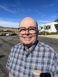
Webinar #93 - Thursday, February 2025
SNOTEL - SNOpack TELemetry Karl Wetlaufer
USDA-NRCS Snow Survey
Denver, CO Karl's presentation will explain the history, logistics, uses, etc of SNOTEL (SNOpack TELemetry), which is a remote backcountry array of weather station equipment that measures snow and transmits the data wirelessly to scientists. More information to follow.
Webinar #94 - Thursday, May 2025
Fog and Dew
Jeff Collett
Atmospheric Chemistry
Colorado State Univ.
Fort Collins, CO
Webinar #95 - Thursday, Summer 2025
What is a ‘100-year rainstorm’? And how many CoCoRaHS volunteers have observed one?” Russ Schumacher
Colorado Climate Center/CoCoRaHS
Colorado State Univ.
Fort Collins, CO 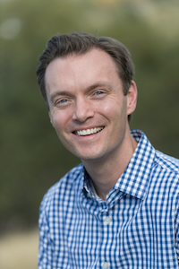
(Biography)
You might have heard in the media about a “100-year” (or even a “1000-year”) rainstorm. Although these concepts are backed by statistics and can be quite useful, they are also very prone to misunderstanding and confusion. In this presentation, we’ll explore what a “100-year storm” means (and doesn’t mean), and how to interpret these estimates. We’ll also look through the CoCoRaHS database to highlight instances where CoCoRaHS volunteers observed storms this extreme, and how those observations have helped advance the scientific understanding of heavy precipitation.
Previous CoCoRaHS WxTalk Webinars
(click on a link below to view a previous WxTalk Webinar)
SEASON THIRTEEN -- Webinars 2024
Special Webinar - January 2024
"A Review of Significant Weather Events Occurring in 2023"
Greg Carbin
NOAA/Weather Prediction Center
College Park, MD Webinar #89 - March 2024
"So you want to be a meteorologist - 2024 update"
Dave Changnon, Victor Gensini
Northern Illinois Univ.
DeKalb, IL Webinar #90 - May 2024
"Monitoring Climate Change at the World Meteorological Organization (WMO)"
Claire Ransom
World Meteorological Organization
Geneve, Switzerland
SEASON TWELVE -- Webinars 2023
Special Webinar - February 2023
"A Review of Significant Weather Events Occurring in 2022"
Greg Carbin
NOAA/Weather Prediction Center
College Park, MD
Webinar #85 - May 2023
"Influences of Thunderstorms on Aviation Turbulence"
Stan Trier
UCAR
Boulder, CO
Webinar #86 - June 2023
"The 420,002,023rd Year of Biomass Burning on Earth"
Tim Brown
Desert Research Institute
Reno, NV
Webinar #87 - October 2023
"Atmospheric Rivers - 2023 update"
Marty Ralph
UCSD/Scripps Institute of Oceanography
La Jolla, CA
Webinar #88 - December 2023
"Bring it on . . . an avalanche of snow musings"
David Robinson
Rutgers Univ.
New Brunswick, NJ
SEASON ELEVEN -- Webinars 2022
Special Webinar - January 2022
"A Review of Significant Weather Events Occurring in 2021"
Greg Carbin
NOAA/Weather Prediction Center
College Park, MD
Webinar #80 - March 2022
"Snow above freezing? Intriguing phenomena and Mountain Rain or Snow citizen science"
Meghan Collins
Desert Research Institute
Reno, NV
Webinar #81 - May 2022
How does the Pacific ocean affect our weather along the U.S. west coast: sea breezes to “ocean-effect” precipitation
Eric Skyllingstad
Oregon State University
Corvallis, OR
Webinar #82 - July 2022
International Lightning
Ron Holle
Holle Meteorology & Photography
Oro Valley, AZ
Webinar #83 - October 2022
The Graphics Boom – How Not to Go Bust
Todd Glickman, Craig Allen
WCBS Radio
New York, NY
Webinar #84 - November 2022
Flood Warning Systems
Mark Moore
National Hydrologic Warning Council
SEASON TEN -- Webinars 2021
Special Webinar - January 2021
"A Review of Significant Weather Events Occurring in 2020"
Greg Carbin
NOAA/Weather Prediction Center
College Park, MD
Webinar #75 - March 2021
"COOP - NOAA's long established citizen observation program
Amy Fritz
NOAA/National Weather Service
Silver Spring, MD
| Webinar #76 - May 2021
Mount Washington Observatory, ‘Home of the World’s Worst Weather'
Brian Fitzgerald
Director of Science and Education
Mt. Washington Observatory
North Conway, NH
| | |
Webinar #78 - September 2021
"Derechos: Nature’s Wall of Wind"
Walker S. Ashley
Northern Illinois University
Geographic and Atmospheric Sciences
DeKalb. IL Webinar #79 - November 2021
"Ice Ice Baby - Predicting Freezing Rain Icing and Impacts"
Jay Shafer
Northern Vermont University-Lyndon (formerly Lyndon State College)
Atmospheric Sciences
Lyndonville. VT
SEASON NINE -- Webinars 2020
Webinar #68 - January 2020
Hunting Hurricanes - Heading Straight into the Eye of the Storm
Warren Madden
NOAA/National Hurricane Center
Miami, FL | |
| Webinar #69 - April 2020
NOAA's Weather Prediction Center -- Part 1: A Quick Overview with a Deeper Dive into QPF/Heavy Rainfall Products
Greg Gallina
NOAA/Weather Prediction Center
College Park, MD | | Webinar #70 - June 2020
An Enlightening Chat about Lightning
Chris Vagasky
Vaisala Inc.
Louisville, CO |
Webinar #71 - September 2020
NOAA Weather Radio
Bruce Thomas
Weather 2020
Kansas City, MO Webinar #72 - October 2020
Awesome or Awful? Ranking Winter Severity with the Accumulated Winter Season Severity Index (AWSSI)
Barb Boustead
NOAA/NWS’s Warning Decision Training Division
Norman, OK
|
Webinar #73 - November 2020
Commercial Weather Sector Innovation: Its Evolution in the Great American Weather Enterprise Joel Myers
Founder, CEO & Chairman
AccuWeather
State College, PA |
|
Webinar #74 - December 2020
Digging out: Understanding WPC’s Winter Weather Desk
Josh Weiss
NOAA/Weather Prediction Center
College Park, MD
| | | | |
SEASON EIGHT -- Webinars 2019
| | | | Webinar #64 - January 2019
Winter Weather, Climate and Snow
Elizabeth Burakowski
Research Assistant Professor
University of New Hampshire
Durham, NH | Webinar #65 & #66 - March, October 2019
Into the wind…Oh, the places mobile radars will go!
Parts One and Two
Karen Kosiba
Center for Severe Weather Research
Boulder, CO |
| Webinar #67 - December 2019
Wind Meteorology as Super Hero: A Primer on Wind Energy and the Global Transition to Renewable Energy
Greg Poulos
ArcVera Renewables
Golden, CO | | | | | | |
SEASON SEVEN -- Webinars 2018
SEASON SIX -- Webinars 2017
| | | | Webinar #56 - January 2017
GOES-R - Going from Black-And-White to High Definition Satellite Observations
Matt Rogers
CIRA
Fort Collins, CO | | Webinar #57 - March 2017
Carbon in the Atmosphere
Scott Denning
Dept of Atmospheric Science
Colorado State Univ.
Fort Collins, CO
| Webinar #58 - May 2017
What is the American Meteorological Society and why is it important to you?
Keith Seitter
American Meteorological Society
Boston, MA | | Webinar #59 - July 2017
Mesoscale convective systems: Bringing both beneficial rains and hazardous weather to the central and eastern US
Russ Schumacher
Colorado State Univ.
Fort Collins, CO | Webinar #60 - November 2017
The National Weather Association (NWA) - who are we, what do we do?
Gail Hartfield
President National Weather Association
National Weather Service
Raleigh, NC | |
|
SEASON FIVE -- Webinars 2016
| | | | Webinar #44 - January 2016
Weather Underground: How 130,000 Personal Weather Stations Make a Difference
Bob Henson, Jeff Masters
Weather Underground
Atlanta, GA | | Webinar #45 - February 2016
Evolving Outdoor Safety through Preparedness Programs
Charlie Woodrum
NOAA/NWS/National Decision Support Services
National Weather Service Headquarters
Silver Spring, MD
| | | | | Webinar #46 - March 2016
The Day in the life of a TV Meteorologist
Alan Sealls
Chief Meteorologist, WKRG
Mobile, AL
| | Webinar #47 - April 2016
The Climate and Weather of the Midwestern United States
Mike Timlin
Midwest Regional Climate Center
Champaign, IL
| | | | | Webinar #48 - May 2016
The Climate and Weather of the U.S. High Plains
Natalie Umphlett
High Plains Regional Climate Center, Lincoln, NE | | Webinar #49 - June 2016
Weather, climate and extremes in the western U.S.
Nina Oakley
Western Regional Climate Center, Reno, NV
| | | | | Webinar #50 - July 2016
The Climate of the Southeast U.S.: Geographic Patterns and Trends in Extreme Weather Events
Chip Konrad
Southeastern Regional Climate Center
Chapel Hill, NC | | Webinar #51 - August 2016
The Weather and Climate of the Northeast U.S.
Samantha Borisoff
Northeastern Regional Climate Center
Cornell University
Cornell, NY
| | | | | Webinar #52 - September 2016
Climate of the South-Central United States: Hot Spot for Extreme Events
Barry Keim, Luigi Romolo, and Alan Black
Southern Regional Climate Center
Baton Rouge, LA
| | Webinar #53 - October 2016
The COMET Program: Freely available online lessons in weather and the natural sciences
Matt Kelsch, Greg Byrd
COMET
Boulder, CO
| Webinar #54 - November 2016
Weather, Climate and Phenology
Theresa Crimmins
National Phenology Network (NPN)
Tucson, AZ
| |
Webinar #55 - December 2016
Climate through a PRISM: Exploring the spatial patterns of climate across the United States
Chris Daly
Oregon State Univ/PRISM
Corvallis, OR |
SEASON FOUR -- Webinars 2015
| | | | Webinar #38 - January 2015
"Avalanches in the US … In a Nutshell"
Simon Trautman
Forest Service National Avalanche Center
Bozeman, MT
|
| Webinar #39 - February 2015
"Agricultural Meteorology: Layer Upon Layer"
Brad Rippey
Mark Brusberg
USDA
Office of the Chief Economist
World Agricultural Outlook Board
Washington, DC
| ===========================
WxTalk Webinar on vacation from
March 2015 - August 2015
===========================
| | Webinar #40 - September 2015
"The history and uses of volunteer weather observations in the United States"
Nolan Doesken Colorado Climate Center, Colorado State Univ., Fort Collins, CO
| Webinar #41 - October2015
"Introduction to the North American Monsoon"
Chris Castro
Univ. of Arizona, Tucson, AZ
| | Webinar #42 - November 2015
"All You Ever Wanted To Know About Lake-effect Snow”
Thomas Niziol
The Weather Channel, Atlanta, GA
|
SPECIAL WEBINAR - December 2015
"A Review of Significant Weather Events Occurring in 2015"
Greg Carbin
NOAA/Storm Prediction Center
Norman, OK | | Webinar #43 - December 2015
"Radiosondes, it’s what’s overhead that counts”
Paul Ciesielski
Colorado State University, Fort Collins, CO |
SEASON THREE -- Webinars 2014
| | | | Webinar #26 - January 2014
The Hydrologic Cycle: How River Forecast Centers Measure the Parts
Greg Story
NOAA/NWS/West Gulf River Forecast Center
Fort Worth, TX | | Webinar #27 - February 2014
Life as a climatologist – what the heck does a climatologist do?
Ryan Boyles
North Carolina Climate Center
Raleigh, NC | | | | | Webinar #28 - March 2014
Keeping an eye on the Blue Marble: How NASA studies Earth’s weather, climate and hydrology from space
Dalia Kirschbaum
NASA/Goddard Space Flight Center
Greenbelt, MD | | Webinar #29 - April 2014
Air Quality: Local, Regional, and Global Perspectives
Sonia Kreidenweis
Colorado State University
Fort Collins, CO | | | | | Webinar #30 - May 2014
Aviation Meteorology: All you ever wanted to know . . . topics from what causes clear air turbulence to how airports’ traffic flow is impacted by weather.
Mike Bardou
National Weather Service Chicago/Romeoville
Romeoville, IL
Robb Kaczmarek
NOAA/NWS/Chicago Air Route Traffic Control Center
Aurora, IL | | Webinar #31 - June 2014
Waterspouts: The Wet-Whirlwind Cousin to the Tornado
Joseph H. Golden
Golden Research & Consulting
Boulder, CO | | | | | Webinar #32 - July 2014
Space Weather: What is it and why should you care?
Rodney Viereck
NOAA/Space Weather Prediction Center
Boulder, CO | | Webinar #33 - August 2014
Weather CSI - Forensic Meteorology
Pam Knox, CCM
University of Georgia
Athens, GA | | | | | Webinar #34 - September 2014
"A day in the life of a NWS Forecast Office"
John Gordon
National Weather Service Forecast Office
Louisville, KY | | Webinar #35 - October 2014
"Atmospheric Rivers"
Marty Ralph
Center for Western Weather and Water Extremes
UCSD/Scripps Institution of Oceanography
La Jolla, CA | Webinar #36 - November 2014
"NOHRSC - The National Operational Hydrologic Remote Sensing Center"
Carrie Olheiser
NOAA/National Operational Hydrologic Remote Sensing Center (NOHRSC)
Chanhassen, MN | |
Webinar #37 - December 2014
"Tsunami Science and Tsunami Warning Systems"
Stuart Weinstein
NOAA/Pacific Tsunami Warning Center
Ewa Beach, HI | SPECIAL WEBINAR - December 2014
"A Review of Significant Weather Events Occurring in 2014"
Greg Carbin
NOAA/Storm Prediction Center
Norman, OK | | | | | | | |
SEASON TWO -- Webinars 2013
| | | | Webinar #14 - January 2013
Flavors of Climate variability: El Nino, La Nina and Recurring Jet Stream patterns
Gerry Bell
NOAA/CPC
College Park, MD | | Webinar #15 - February 2013
"Educated Echoes: An Introduction to Doppler and Dual-polarization Weather Radar "
Pat Kennedy
CHILL Radar
Colorado State University
Fort Collins, CO | | | | | Webinar #16 - March 2013
"I before E" Except in Drought
Mark Svoboda
NDMC
Lincoln, NE | | Webinar #17 - April 2013
Forecasting the Ferocious: The How, What, Where and Why of Tornadoes
Greg Carbin
NOAA/Storm Prediction Center
Norman, OK | | | | | Webinar # 18 - May 2013
At the Cutting Edge: Harry Wexler and the Emergence of Atmospheric Science
Jim Fleming
Colby College
Waterville, ME | | Webinar #19 - June 2013
Monitoring the Earth's Climate
Deke Arndt
NOAA/National Climatic Data Center
Asheville, NC | | | | | Webinar #20 - July 2013
Rainwater Harvesting - Catching and Using It
Billy Kniffen
American Rainwater Catchment Systems Association (ARCSA)
Menard, TX | | Webinar #21 - August 2013
Atlantic basin seasonal hurricane prediction and the forecast for the 2013 Atlantic hurricane season
Phil Klotzbach
Colorado State University
Fort Collins, CO | | | | | Webinar #22 - September 2013
The Hundred Hunt for the Red Sprite
Walt Lyons
FMA Research, Inc.
Fort Collins, CO | | Webinar #23 - October 2013
Meteorological Instruments -- Everything you wanted to know, but were afraid to ask!
Stephen Burt
Univ. of Reading
Reading, UK | | | | | Webinar #24 - November 2013
Weather Modification: Does the seeding of clouds enhance precipitation? An old question revisited
Bart Geerts
Univ. of Wyoming
Laramie, WY | | SPECIAL WEBINAR - November 2013
"A Review of Significant Weather Events Occurring in 2013"
Greg Carbin
NOAA/Storm Prediction Center
Norman, OK | | | | | Webinar #25 - December 2013
Climate Change, Ecology, and Disease Emergence – A Public Health Perspective
Ben Beard
NCEZID Centers for Disease Control
Fort Collins, CO | | |
SEASON ONE -- Webinars 2011 - 2012
| | | Webinar #1 - December 2011
Snow, love it , hate it . . . it still falls on us all!
David Robinson, Rutgers Univ.,
Nolan Doesken, Colorado State Univ.
| | Webinar #2 - January 2012
Remote sensing: How weather satellites sense the earth
Arunas Kuciauskas
Naval Research Laboratory
Monterrey, CA |
| | | Webinar #3 - February 2012
Who Uses Weather and Climate Data and How Do They Do It?
Steve Hilberg
Midwest Regional Climate Center (Retired)
Champaign, IL | | Webinar #4 - March 2012
Understanding and Identifying Clouds
Tom Schlatter
NOAA/Earth System Research Laboratory
Boulder, CO
| | | | | Webinar #5 - April 2012
Flash Floods: It's More Than a Bunch of Rain
Matt Kelsch
UCAR/COMET
Boulder, CO | | Webinar #6 - May 2012
Lightning and Its Impacts
Ronald L. Holle
Holle Meteorology & Photography
Oro Valley, AZ | | | | | Webinar #7 - June 2012
Hurricane Analysis and Prediction at the National Hurricane Center
Chris Landsea
NOAA/NWS/National Hurricane Center
Miami, FL | | Webinar #8 - July 2012
Wind and Wildfire - A Dangerous Combination
Liz Page
UCAR/COMET
Boulder, CO | | | | | Webinar #9 - August 2012
Extreme Rainfall, How We Analyze It and How The Data is Used
Bill Kappel
Applied Weather Associates
Monument, CO | | Webinar #10 - September 2012
So You Want to Become a Meteorologist?
Dave Changnon
Northern Illinois University
DeKalb, IL | | | | | Webinar #11 - October 2012
When Howling Wolves Greet the Northern Lights
Jan Curtis
USDA/NRCS
Portland, OR | | Webinar #12 - November 2012
Weather Optics - "There are more 'bows' in the sky than just rainbows"
Grant Goodge
Earth Resources Technology, Inc.
Laurel, MD | | | | | Webinar #13 - December 2012
Historic Winter Season Weather Events : What's the best of the worst.....
Paul Kocin
NOAA/NWS/Hydrologic Prediction Center
College Park, MD
| | |
|
|